Greater Rosemont and the Movement Against Destruction
Text
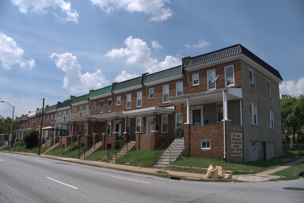
Today, the parking lot of the West Baltimore MARC Station and the concrete highway lanes to the east dominate this site, symbols both of the weight of the past and prospects for the future.
In the 1970s major demolition occurred in the corridor to the east to build the first leg in a proposed East-West expressway, envisioned as the eastern extension of Interstate 70. The route was to proceed west along a corridor directly through the Greater Rosemont communities and continue on through the heart of Gwynns Falls/Leakin Park. African American residents in this section of the city fought the road plan under the banner of RAM (Relocation Action Movement). The organization joined with city-wide expressway opponents under the umbrella of MAD (the Movement Against Destruction), a coalition that cut across lines of race, class, and differing interests in opposition to various sections of the proposed expressway system. In the late 1960s, the city condemned hundreds of houses along the corridor to the west of this site for the proposed highway. However, mounting protests initially forced the decision to designate an alternate route and eventually to abandon the section through Greater Rosemont and the parks to the west altogether. Soon, the one-mile stretch of expressway that was completed with such controversy and such cost—economic as well as social—was being called “The Road to Nowhere.”
To the west of the station, between Franklin Street and Edmondson Avenue stand 880 houses condemned by Baltimore officials for the proposed construction of the East-West Expressway in the late 1960s, little more than a decade after African Americans had seized the opportunity to acquire homes in neighborhoods formerly closed to them. Witnessing the process immediately to the east where condemnation already had occurred (and demolition was imminent) for the artery to be built between Franklin and Mulberry Streets, Greater Rosemont residents became active in the Relocation Action Movement, which united with others opposing various sections of the proposed expressway system across the city under the banner of MAD.
In April 1968, civil disturbances convulsed the city in the aftermath of the assassination of Martin Luther King, Jr., adding to the general climate of heightened social tension between Baltimore’s citizens and its officials. For RAM, the highway threat was a civil rights issue. As an example, when the group’s proposal for an underground roadway to spare residences was rejected on the grounds that it would be too expensive, a member exclaimed, “It always has been expensive to operate a segregated society.” James Dilts, in a series of articles in the Sun that year, decried the logic of the expressway plan, which he believed amounted to destroying parts of the city and harming its residents, even as it promised to improve the city.
Late in 1968, mounting opposition to the Greater Rosemont route led Mayor Thomas D’Alesandro, III, to propose an alternative that would bypass the affected neighborhoods by following a route along the railroad line to the south. However, the following year, when the city announced a plan to sell the formerly condemned houses back to their original owners, only half took up the offer, the remainder having decided to move out for good. A 1970 Sun article referred to Rosemont as “a once stable middle-class Negro community which was devastated by plans to build the East-West Expressway through its core.”